
Sports
Asian soccer body joins opposition to FIFA and Infantino's World Cup private equity plan
By Marcus Chen
ClickOrlando Sports
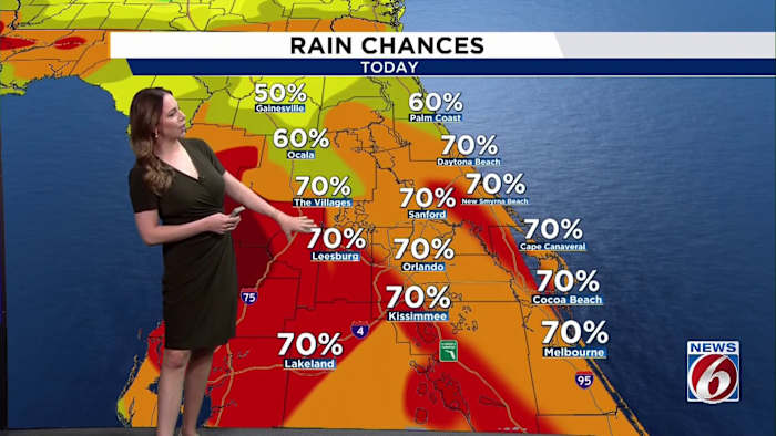
Keep the raingear close by this weekend. Central Florida remains in a very humid and unsettled weather pattern, bringing rounds of daily downpours and a few strong storms.FRIDAYAfter a few early morning showers, additional thunderstorms are expected to develop as temperatures heat up into the afternoon. Rain chances remain elevated at 60-70% as some storms could produce lightning, gusty winds and heavy downpours.High temperatures will reach the lower 90s, with heat index values between 100 and 105 degrees before storms develop.WEEKENDSaturday through Monday looks to be the wettest stretch of the forecast. Rain chances increase to 60 to 80 percent each afternoon as deep tropical moisture remains in place and weak disturbances continue moving across the state.Unlike a typical summer pattern, storms may develop earlier in the day or linger into the evening. The greatest concerns remain frequent lightning, gusty winds, and heavy rainfall that could lead to localized flooding.Temperatures w
Ad Space Available
mid-article · 728px
By Marcus Chen
ClickOrlando Sports

By Katherine Langford
WFTV Orlando Local

By Katherine Langford
WFTV Orlando Local

By Marcus Chen
FOX 35 Orlando